Miss. Baptist Disaster Relief tracking severe weather

JACKSON, Miss. (Special) – Mississippi Baptist Disaster Relief (MBDR) has alerted response teams to be prepared to mobilize if anticipated severe weather Nov. 29-30 causes extensive damage in the state.
“MBDR is placing several assessment, chainsaw, and chaplain teams on standby to assist if needed and will be monitoring the developing event,” said Hubert Yates, disaster relief director at the Mississippi Baptist Convention Board in Jackson, on the morning of Nov. 28.
“The current forecast for severe weather calls for rain and storms to begin around mid-day on Tuesday as a warm front lifts from south to north through the State,” Yates reported.
There is a possibility threat levels may be increased as the strongest part of the storm moves into the state, and the Delta and northeast regions could be elevated to a Level 5 High Risk category by the National Weather Service on the morning of Nov. 29, he said.
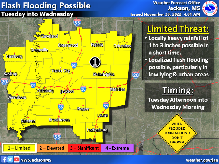
“Tornadoes (some may be strong and long track, particularly in the Moderate and Enhanced Risk areas), high winds, lightning, hail, heavy rains, and flash/urban flooding are to be expected with the system passage,” Yates pointed out in his Nov. 28 statement.
“If the low pressure shifts slightly farther north on its track, then we may see a slight decrease in risk. In either case, tomorrow afternoon, evening, and night will be a period to be watched
“As the squall line associated with the cold front passes through the state by early Wednesday morning, conditions should improve. The system is currently forecast to weaken and decrease [in intensity] the farther east and south the front moves,” he said.
For severe weather safety tips from the National Weather Service, click here.